


2021 Draft Master Plan Community Engagement
As Hornsby Shire’s population grows, so too does the need for a wide variety of open and green spaces. To cater for this long-term demand, Council developed a draft master plan for a new regional sized park at Westleigh.
The draft Master Plan was exhibited for a total of eight weeks from 21 April to 16 June 2021. During this time, we received 293 written submissions, held six stakeholder meetings which were attended by approximately 69 people and engaged with 785 people at three swing bys.
There were also two surveys prepared as part of the community consultation. A total of 1,878 responses were received from Elton’s opt-in, online survey and a representative, two stage phone/online survey by Micromex was completed by over 300 participants.
The main themes that emerged through the various channels during the engagement period included:
- mountain bike trails
- bushland biodiversity
- sports platforms
- traffic concerns and impacts
- link between Hornsby and Westleigh Parks
- community facilities
- indigenous history.
View the Engagement Outcomes Report – Elton Consulting July 2021 (PDF 6.3MB)
View Micromex’s phone survey results (PDF 3.5MB)
Following community engagement, the draft Master Plan was presented to a General Meeting on 14 July 2021. Councillors resolved to defer adopting the master plan to allow more time for staff to consult with the stakeholder groups to find solutions to the issues raised in the business paper.
You can read the draft Master Plan here:
What is proposed for Westleigh Park?
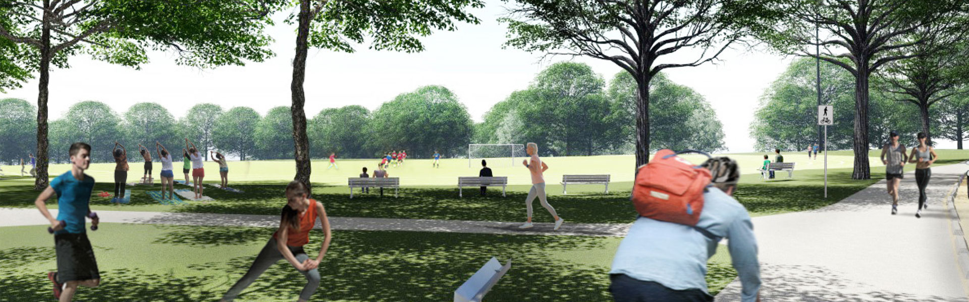
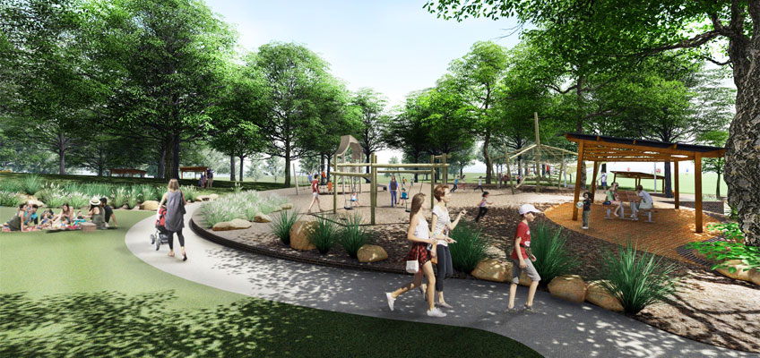
Westleigh Park will not be a single-purpose facility – rather, it will offer a range of active and passive recreation opportunities to cater for the diverse needs of the community. Examples may include, but are not limited to:
- community-based sport
- opportunities for school and club athletics
- cycling and mountain biking
- informal exercising and walking
- children’s playground
- bushwalking, and
- passive recreation such as picnic areas.
The current proposal is for three sports facility platforms that have been designed to work within the constraints of the existing bushland vegetation and the future provision of improved road access.
Athletics Track and Support Facilities
To the north in the narrowest section of the previously cleared lands, a platform is proposed which can support a senior competition athletics track and internal field area. Surrounding grassed areas are proposed to accommodate field events to supplement the centre grassed field.
Central Multi-purpose Sportsfield Platform
A multipurpose field platform is proposed in the centre of the site. The available space through this area could accommodate a turf surface or alternatively, a synthetic surface to meet demand. This field is intended for multiple sports and activities.
Southern Multi-purpose Natural Turf Sportsfield Platform
The south of the site provides the widest area where a full senior size playing field platform can be accommodated, taking into consideration the protection of the adjoining bushland. The draft master plan illustrates a multipurpose playing field platform which accommodates either two (2) full competition size football fields or a full-size AFL field, with a full-size cricket ground during summer.
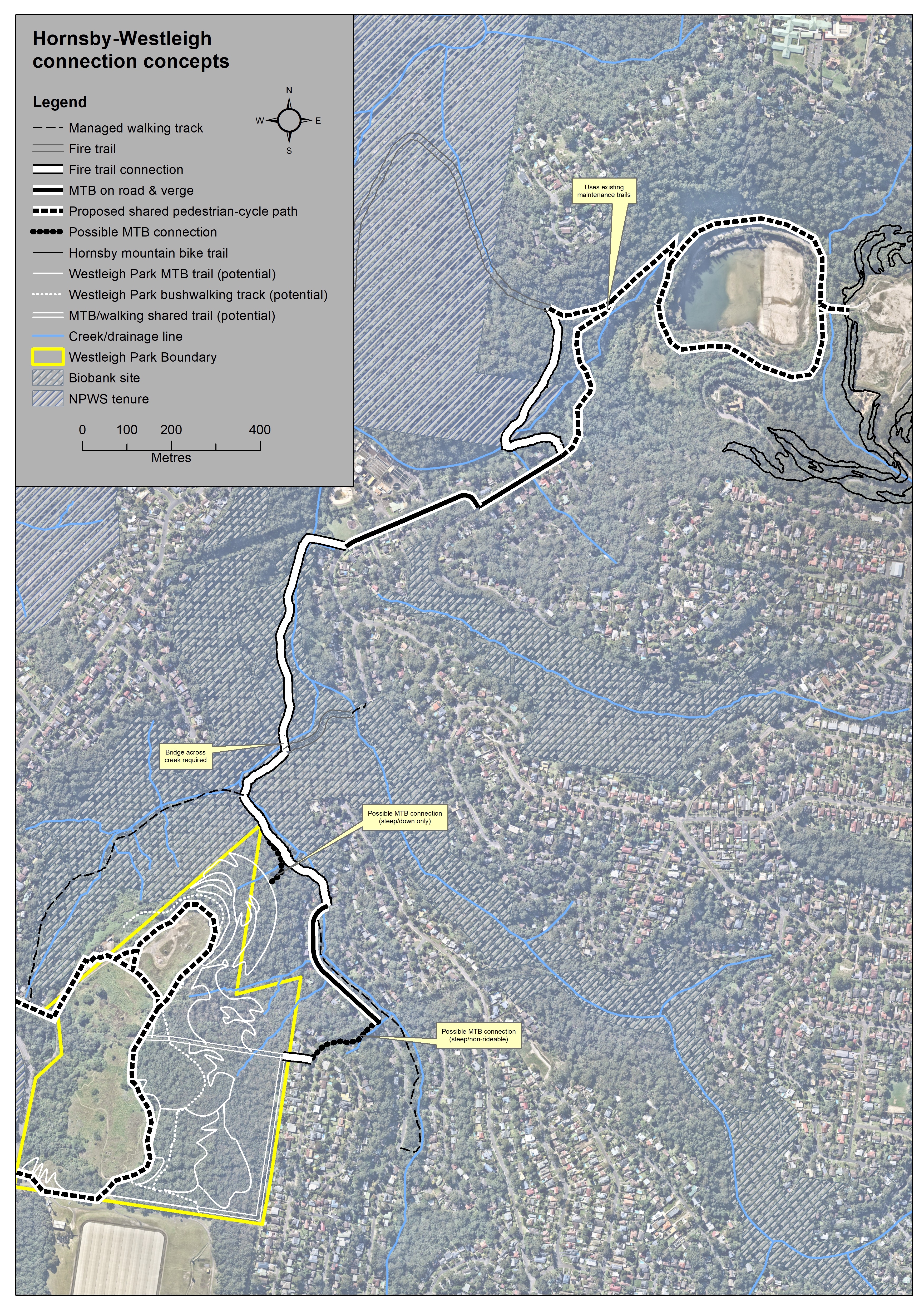
Along with organised sports, the park could also cater for unstructured recreation such as cycling, mountain biking, dog walking and bushwalking. It is proposed that the new park will be linked to Ruddock Park with improved shared pathways, to Berowra Valley National Park, adjoining bushland and Hornsby Park by existing and improved connections.
Background Information
In June 2016, Council purchased 36 hectares of land in Westleigh from Sydney Water.
Located along the eastern side of Quarter Sessions Rd, the land had been earmarked by Sydney Water for housing, however Council’s plans were to provide for a range of recreational facilities and for the conservation of bushland.
Why did Council buy the land?
Council purchased the land in order to provide additional sportsgrounds in the future. Although formal sportsgrounds won’t be ready for some years, owning the land provides an exciting opportunity for Council to give residents what they're asking for. See Council’s Sportsground Strategy which highlights the demand for this site to be developed for sports. These new facilities will work towards addressing the current shortfall of sportsgrounds within the Shire.
The site will also be able to provide spaces for passive recreation, such as walking and picnics and unstructured recreation such as mountain bike trails.
What is there at the moment?
Currently about a third of the land is cleared, and this is surrounded by bushland which covers the remaining two thirds.
The site is bounded to the north by Dog Pound Creek bushland (BioBanking site), to the east by Waitara Creek bushland and to the west by Berowra Valley National Park. The site itself is home to several threatened species and five vegetation communities, including;
- Sydney Turpentine Ironbark Forest (Critically Endangered Ecological Community)
- Duffy’s Forest (Endangered Ecological Community)
- Scribbly Gum Open Woodland
- Bloodwood Scribbly Gum Woodland
- Peppermint – Angophora Forest
Council will work closely with experts to protect and enhance the significant environmental features of the site.
Unsanctioned mountain biking and walking trails have been established on the site for some time and Council has identified an alternative configuration to reduce the impact on sensitive vegetation.
Mountain Bike Trails and Bushwalking Tracks
Currently there are unsanctioned mountain bike tracks on site. Council’s is working with the community, ecologists, and design specialists to identify alternative alignments that avoid and minimise impacts on high value biodiversity.
Improved Access for Traffic and Car Parking
As part of the draft Master Plan, the following access improvements have been proposed:
- junction upgrades on Quarter Sessions Road
- new access road (extension of Sefton Road to Quarter Sessions Road)
- 350 car parking spaces and
- extended bike and pedestrian access pathways to reduce the dependency on vehicle access.
The proposed traffic and parking plans allow for better management than currently exists. Having two points of entry and exit will spread the peak traffic flow and provide greater public safety. In parallel, intersection upgrades at Duffy Avenue / Chilvers Road / Sefton Road and at Sefton Road / Chilvers Road are also being planned.